SATS data are available through different channels to anyone with internet access. The links on this page provide access to different formats and types of data, which vary depending on the methodologies and platforms used to collect them. These datasets can be used to address a wide range of scientific questions. Explore the available data and download options, and choose how to access the data according to your needs.
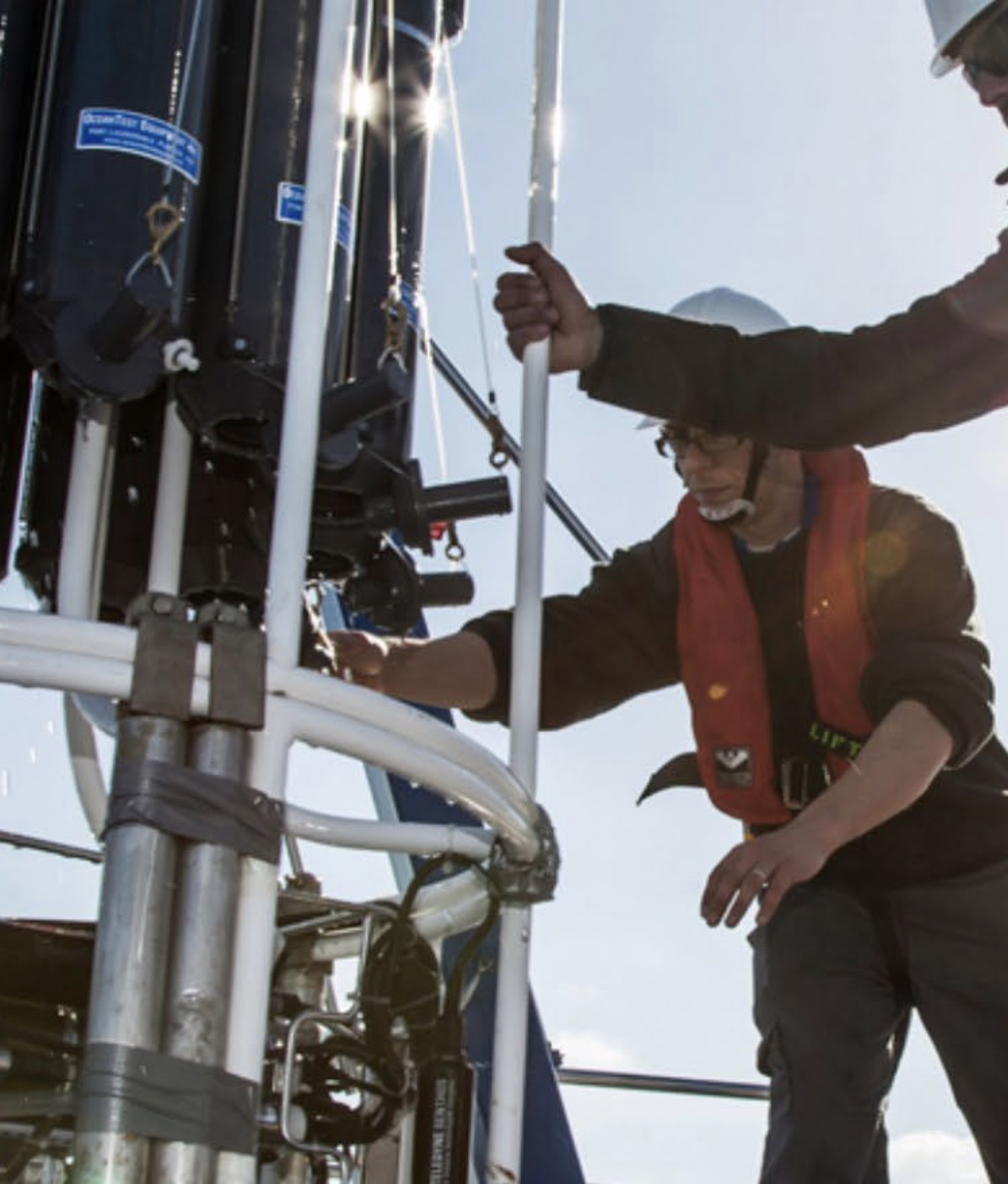
As part of the long-term observation program of the Spanish Institute of Oceanography (IEO-CSIC), the deep station of the Santander section—representing full water column observations (CTD profiles) at the SATS station—has enabled the monitoring of oceanographic conditions at this site since 1994, specifically:
The evolution of water mass properties (Eastern North Atlantic Central Water – ENACW, Mediterranean Water – MW, and Labrador Sea Water – LSW)
Changes in the vertical structure of the ocean (mixed layer depth and stratification)
From this infrastructure, the following data series are obtained:
In addition to the regular CTD profiles that provide water column observations at the SATS station, the AGL ocean-meteorological buoy was deployed in June 2007. It is part of the same observing system and is equipped with atmospheric, oceanographic, and biogeochemical sensors. This platform, moored at 2,870 m depth in offshore waters, provides data on: Climate variability and biogeochemical processes in response to ocean–atmosphere interactions, mixing processes, and circulation Changes in dissolved oxygen content
From this infrastructure, the following data series are obtained:
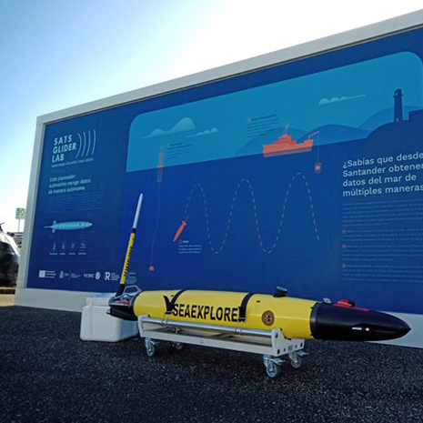
Gliders, autonomous underwater vehicles, were incorporated as a new observation tool within SATS in 2024, carrying out their first missions in 2025. Glider data provide a more comprehensive picture of ocean conditions, particularly below the surface down to 1,000 meters depth and in the transition zone between the open ocean and coastal areas. The missions of Jimena and Juan, as our gliders are named, combine sustained monitoring with process- and event-based studies, delivering unprecedented insights into ocean dynamics. From this infrastructure, the following data series are obtained: